Panoramica
15 Maggio 2019
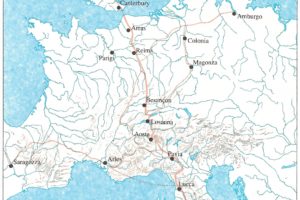
Pescia “quasi” sulla Via Francigena, quella principale o classica che nel 990 percorse l’arcivescovo Sigerico, di ritorno da Roma e diretto a Canterbury e che nella nostra zona tocca Lucca, Capannori, Porcari, Altopascio, Galleno, Fucecchio.
Località a Pescia prossime e che da Pescia potevano essere raggiunte percorrendo antiche strade risalenti addirittura ai tempi di Roma.
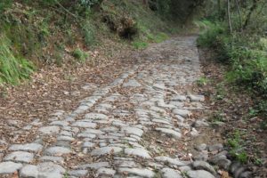
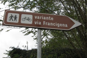
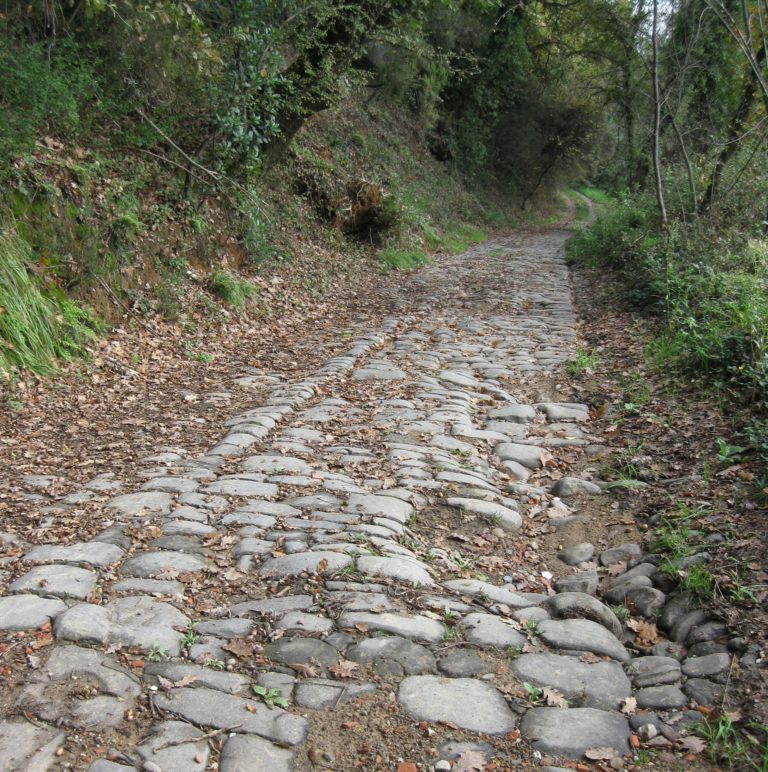
Importante era anche la viabilità Firenze-Pistoia-Pescia-Lucca e di questa rimane una suggestiva traccia nel tratto che parte da Veneri di Pescia (tratto conosciuto anche come “Antica Strada Maestra Postale Lucchese”) e che presento nelle foto. La segnaletica la considera giustamente una “variante” della Francigena (detta anche Romea, o Francesca, o Romana, dizioni ricordate ancor oggi nella toponomastica in Valdinievole).
Terra di frontiera tra Etruschi-Romani e Liguri, e dunque anche di scambio e di commercio verso la Francia ma anche di transito verso il Nord Italia , Pescia e la Valdinievole sono interessate al tema della grande viabilità di epoca romana e medievale.
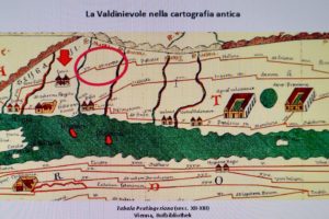
E’ indubbio il passaggio di una strada Firenze-Lucca nell’antichità, da qualcuno definita “Cassia Minor”, e che sarebbe appunto la strada selciata di Veneri alla quale abbiamo già accennato. Secondo però il locale dottor Francesco Tanganelli non si hanno prove decisive al momento sul tracciato preciso – né sugli esatti punti di passaggio dei vari corsi d’acqua, in primo luogo quello della Pescia Maggiore. Argomento principe è poi la possibilità che Pescia sia la località “Ad Martis” presente sulla celebre “tabula” del sec. XII-XIII d.C., che si reputa però copiata da una mappa d’età romana. Sulla “tabula”, “Ad Martis” si trovava a circa metà percorso tra Lucca e Pistoia, e quindi grosso modo nella zona di Pescia. “Ad…Martis” va riconosciuta forse come una stazione di sosta, il cui nome potrebbe forse sottintendere la presenza di un vicino tempio o anche solo di una statua dedicata al dio Marte, ma la toponomastica locale (“Marzalla”) consente qualche speranza di avere una conferma che potrebbe venire solo – sempre secondo il dottor Tanganelli – da futuri scavi e scoperte. Le comunicazioni includevano naturalmente all’epoca anche l’utilizzo della navigazione, che toccava anche il Mar Tirreno e il corso dell’Arno, forse accessibile attraverso il canale Usciana ed un Lago di Fucecchio molto più esteso della situazione attuale del Padule. Da Pescia in direzione sud, per esempio, la Via Francigena principale poteva essere raggiunta, per via d’acqua appunto , attraverso il Lago – Padule di Fucecchio.
© Paolo Landi.
English version
PHOTO-NEWS 12: PESCIA IS ALMOST ON THE VIA FRANCIGENA
Pescia weighs “almost” on the Via Francigena, the main or classic Francigena, the one that in 990 crossed the Archbishop Sigerico, returning from Rome and headed to Canterbury and that in our area touches Lucca, Capannori, Porcari, Altopascio, Galleno, Fucecchio.
Places in Pescia near and that could be reached from Pescia along ancient roads dating back to the time of Rome. Important was also the road network Florence-Pistoia- Pescia- Lucca and this remains a striking trace in the stretch that starts from Veneri of Pescia (also known as “Antica Strada Maestra Postale Lucchese“) and that I present in the pictures. The signs rightly consider it a “variant” of the Francigena (also known as Romea, or Francesca, or Romana, words still remembered today in the toponymy in Valdinievole).
Land of border between Etruscans-Romans and Ligurians, and therefore also of exchange and trade towards France but also of transit towards Northern Italy, Pescia and Valdinievole are interested in the theme of the great road network of Roman and medieval times.
There is no doubt that in ancient times there was a road between Florence and Lucca, which someone called “Cassia Minor”, and which would be precisely the paved road of Veneri to which we have already referred. However, according to the local Dr. Francesco Tanganelli there is no decisive evidence at the moment on the precise route – nor on the exact points of passage of the various waterways, first of all that of Pescia Maggiore. The main argument is also the possibility that Pescia is the locality “Ad Martis” present on the famous “tabula” of the twelfth-thirteenth century AD, which is believed, however, copied from a map of the Roman era. On the “tabula”, “Ad Martis” was about halfway between Lucca and Pistoia, and then roughly in the area of Pescia. “Ad…Martis” should perhaps be recognized as a resting place, whose name could perhaps imply the presence of a nearby temple or even just a statue dedicated to the god Mars, but the local toponymy (“Marzalla”) allows some hope to have a confirmation that could only come – always according to Dr. Tanganelli – from future excavations and discoveries. At the time, the communications naturally also included the use of navigation, which also touched the Tyrrhenian Sea and the course of the Arno, perhaps accessible through the Usciana canal and a Lake of Fucecchio much larger than the current situation of the Marshes. From Pescia in a southerly direction, for example, the main Via Francigena could be reached, by water, through the Lake – Padule di Fucecchio.
© Paolo Landi.

La “Tabula Peutingeriana” dove il cerchio indica la località romana “Ad… Martis“, a metà strada tra Lucca e Pistoia e che i pesciatini (ma qualche esperto è dubbioso) vorrebbero che fosse proprio Pescia e la sua amena località collinare denominata da tempo “Marzalla“. La freccia di sinistra indica Luca (Lucca), la freccia di destra Florentia (Firenze). © Paolo Landi.
The “Tabula Peutingeriana” where the circle indicates the Roman locality “Ad… Martis”, halfway between Lucca and Pistoia and that the inhabitants of Pescia (but some experts are doubtful) would like it to be Pescia and its pleasant hilly location called for some time “Marzalla”. The left arrow points to Luca (Lucca), the right arrow Florentia (Florence). © Paolo Landi.
Below are three photos of sections paved with Veneri of Pescia of what is certainly an ancient route of Florence – Lucca, with a photo of the current signs that define it as “Variante Via Francigena” and a Madonna’s aedicule on the path. © Paolo Landi.
Seguono fotografie relative a tre tratti selciati a Veneri di Pescia di quella che è sicuramente un antico tracciato della Firenze- Lucca, con una foto dell’attuale segnaletica che la definisce “Variante Via Francigena” ed una margine presente sul percorso. © Paolo Landi.
© Paolo Landi.

Il selciato in molti tratti è stato purtroppo danneggiato dal passaggio di mezzi motorizzati e moto, nonostante gli ovvi divieti presenti. © Paolo Landi.

© Paolo Landi.

La mappa della Via Romea o Francigena principale (Canterbury-Roma) di Sigerico del 990. E’ tratta dal libro “La Via Romea- Cammino di Dio”, di Giovanni Caselli, edizioni Giunti, 1990.
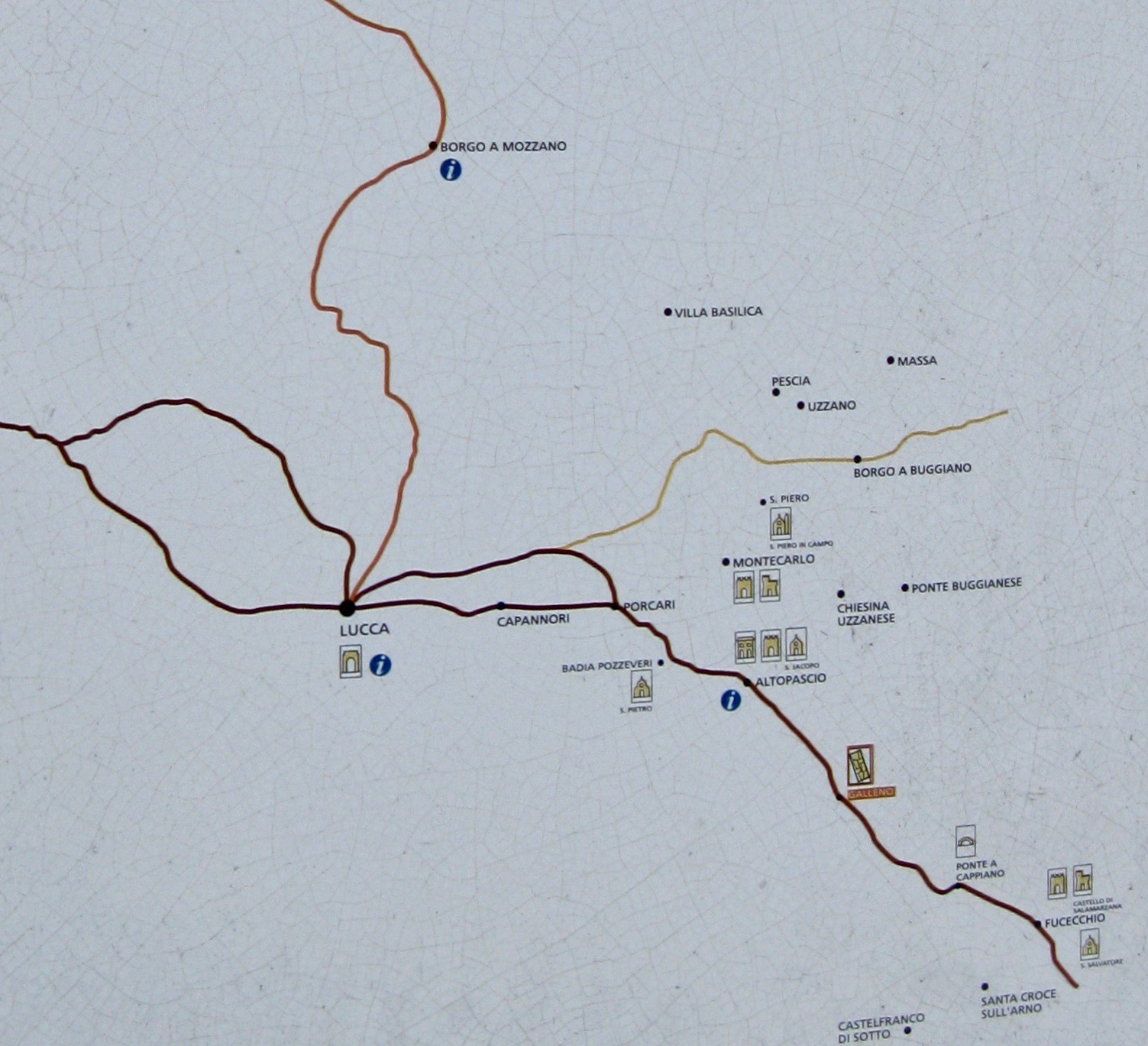
I pannelli lungo la “Francigena” segnalano anche le “varianti” come quella a sud di Pescia , a Veneri.

Antica strada Firenze-Lucca, nel cartello giustamente è riportata la parola “variante” della Via Francigena (ndr). Foto © Paolo Landi.
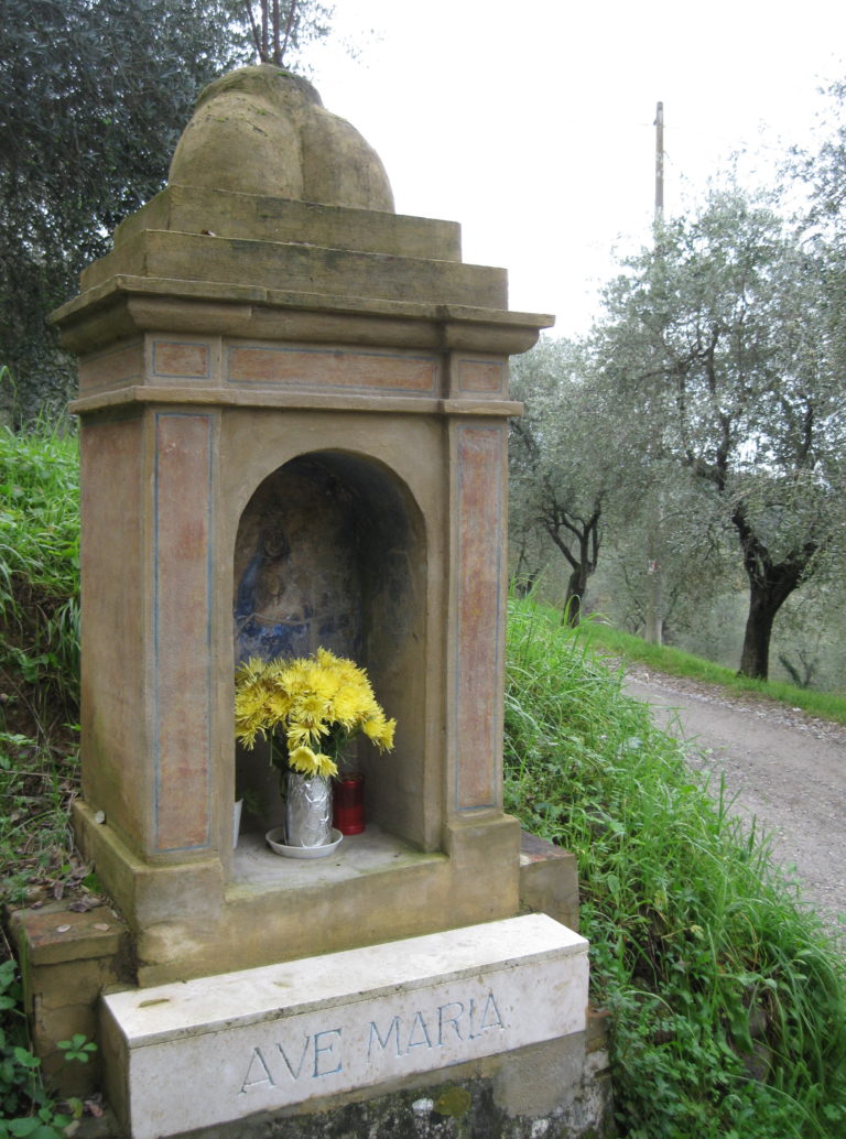
Antica strada Firenze-Lucca: un edicola mariana sulla via (ndr). Foto © Paolo Landi.
Commenta
Mappa
visto 2510 tempi, 1 Visita oggi


